ComNav Technology‘s T300 GNSS Receiver: Decade Passed, Legend Still


Despite a decade of evolution, the T300 GNSS Receiver has managed to retain its timeless appearance. The classic design serves as a symbol of continuity and reliability in a rapidly changing industry. This consistency in design is not merely an aesthetic choice but reflects the steadfast dedication to providing users with a familiar yet highly capable tool.

Initial debut at INTERGEO 2013 in Germany
Over the past ten years, the T300 has embarked on a remarkable journey of continuous innovation. Since its debut in 2013, the T300 has not only maintained its iconic design but has also consistently evolved to stay at the forefront of GNSS technology. With a keen focus on enhancing performance and expanding capabilities, ComNav Technology's T300 has truly epitomized the spirit of progress.

An illustration of the 10-year timeline
In 2013, the T300 made its mark by introducing the K5 platform, supporting GPS, GLONASS, and BeiDou-2.
As the industry evolved, so did the T300. The transition to the K7 platform in subsequent years brought with it the inclusion of Galileo support in 2018. As the Beidou-3 satellite navigation system was completed in 2020, T300 expanded the constellation tracking capability again.
The T300's journey didn't stop there. With the introduction of the K8 platform, the T300 now offers 965 channels with full constellation and multi-frequency, further elevating its positioning accuracy. With each upgrade, ComNav Technology solidified its commitment to keeping the T300 in line with the latest advancements in global navigation. The integration of Wi-Fi support into the T300's feature set facilitated data transfer, Web server is easier to configure. Meanwhile, it reduced power consumption, ensuring longer operation times in the field. Additionally, it has enhanced its interference detection and mitigation functions, rendering the T300's positioning results even more reliable in complex environments, such as near buildings or in dense jungles.
With the commitment to delivering practical solutions to customers, the T300’s application has expanded to surveying and mapping, UAV, precision agriculture, construction, GIS, and so on.

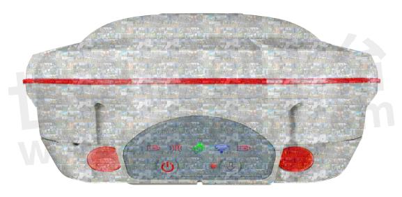
A composite image created by customers featuring the T300
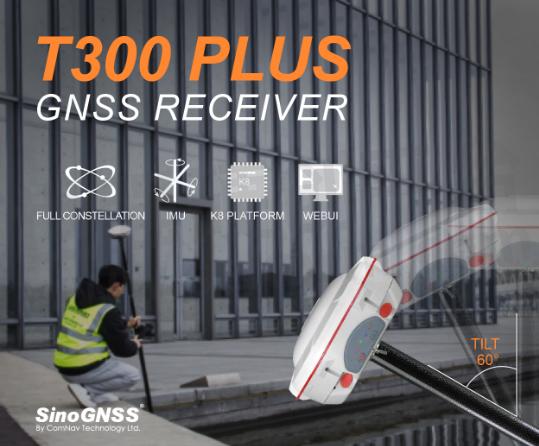
Simultaneously, as a member of the T300 series, the T300 Plus combines with an Inertial Measurement Unit (IMU) module, supporting tilt compensation of up to 60°, while maintaining high precision within 2.5 centimeters. This significantly enhances on-site efficiency, convenience, and reliability, all without the need for cumbersome magnetometer and accelerometer calibrations.

T300 Plus with 60° Tilt Compensation
Despite a decade of evolution, the T300 has managed to retain its timeless appearance. This consistency in design is not merely an aesthetic choice but reflects the steadfast dedication to providing users with a familiar yet highly capable tool.
The widespread praise and positive feedback from global customers affirm the T300's trustworthiness. It excels in various applications and environments, leaving its mark across the world.
Now, let's turn ComNav Technology's attention to Mexico, where ComNav Technology has received valuable feedback from ComNav Technology's customers. Their experiences further underscore the T300's exceptional performance, even in demanding conditions like dense vegetation and urban environments.

T300 in Mexico
When “innovation” is becoming a sales pitch, the classic design and up-to-date prowess of T300 showcased that while external appearances may change in an instant, true innovation requires the precipitation of core technology. ComNav Technology's focus extends beyond mere product replacements; it encompasses substantial technological advancements and the potential for innovation.
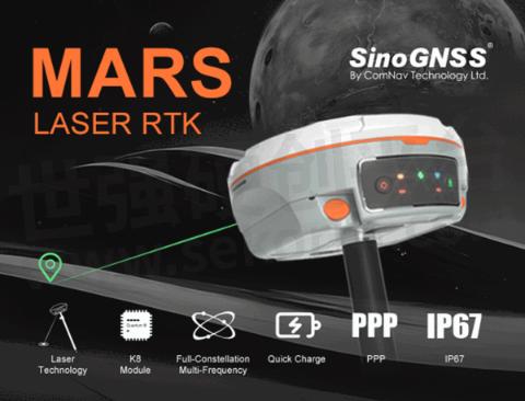
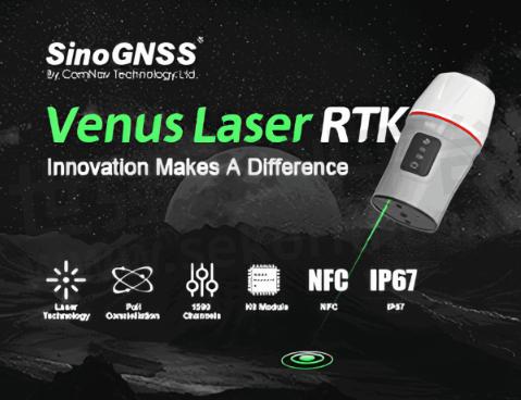
And we, ComNav Technology, is the practitioner of innovation. The Universe Series GNSS Receiver exemplifies this perfectly.
Introducing laser technology simplifies surveying and stake-outs in challenging environments, such as hard-to-reach, signal-obstructed, and hazardous areas. This innovation delivers unparalleled stability and accuracy and significantly ensures the users’ safety.


ComNav Technology's practice in innovation and persistence in R&D truly embodies ComNav Technology's progressive spirit. It acts as a guiding beacon, propelling navigation technology toward the promising horizons of the future.
- |
- +1 赞 0
- 收藏
- 评论 0
本文由翊翊所思转载自ComNav Technology News,原文标题为:T300 GNSS Receiver: Decade Passed, Legend Still,本站所有转载文章系出于传递更多信息之目的,且明确注明来源,不希望被转载的媒体或个人可与我们联系,我们将立即进行删除处理。
相关推荐
【IC】RTK固件重大升级,司南导航K8模块性能全面进化!为测量测绘、精准农业、无人机等行业提供更广阔发展
面对高精度定位应用场景日益复杂化,司南导航旗下全资子公司钦天导航再次迎来K8系列模块的“进化”——V8固件全新升级。V8固件的引擎、架构、算法全维度焕新,将为测量测绘、精准农业、无人机和机器人等多样化行业应用,打开更广阔的发展空间。
ComNav Technology‘s Z30 Portable GNSS Receiver: Precision in Your Pocket
ComNav Technology is proud to introduce the Z30, a new-generation portable high precision GNSS receiver. This new device combines a host of advanced features into a compact, versatile package, making it the perfect choice for a wide range of industries.
【产品】支持信号为7星26频的司南导航高精度定位模块K8系列,为RTK精度和稳定性提供保障
又到了测绘开工季,你的RTK利器准备好了吗?自司南导航K8系列高精度定位模块在北斗重大专项比测项目夺冠,喜讯公布之后很多用户抱着极大的好奇 提出了自己的疑问。本文将一一解答。
【技术】GNSS模块/板卡数据质量快速评估方法详解:零基线法和原始数据质量分析法
随着北斗三号的全球组网以及LBS、物联网和智能驾驶的发展,GNSS模块开始向小型化、集成化方向发展,GNSS应用也从专业应用走向大众应用。对用户而言,GNSS仍具有较强的专业性,在使用中难免会遇到各类问题。本文介绍GNSS模块的快速评估方法供大家参考。
【经验】深度解析GNSS模块的冷/热启动是什么?
GNSS的基本定位原理是卫星不间断地发送自身的星历参数和时间信息,用户在接收到这些信息后,经过计算得出模块的三维位置、三维方向以及运动速度和时间信息。信号强度、芯片运算能力存在差异,将模块定位时长按快慢进行排序:热启动>温启动>冷启动。
【应用】司南导航小巧轻便的T300 GNSS接收机助力高精度打桩项目,无需预先作业,支持向导功能可轻松调查工作流程
T300 GNSS接收机采用司南导航完全自主知识产权的RTK算法,集GNSS主板、数据链、4G、蓝牙、大容量存储等模块于一体,结构精致简约,小巧轻便。T300全面支持BD-2、BD-3、GPS、GLONASS、Galileo、QZSS、IRSS系统。
实现毫米级实时定位,司南导航提供车规级高精度GNSS定位模块
2022年5月1日,司南导航(股票代码:833972)与世强达成合作,授权世强代理旗下全线产品,为用户提供全方位、多领域的高精度北斗芯片和高精度GNSS芯片、板卡、终端和系统解决方案。司南导航产品已全线上线平台,搜索“司南导航”即可获取更多产品资讯。
【应用】司南导航AG360北斗农机自动驾驶系统助力农机导航,定位误差不超过±2.5厘米且支持AB线共享作业
司南导航的农机导航产品,不仅操作简单、信号稳定、适配广泛,而且还提供24小时售后服务。让农业生产更加高效、节省成本,同时保证农业生产的质量和产量,为农业生产带来更多的福音。
ComNav technology‘s latest GNSS technology : Dual-engine RTK Technology, Realizing the Simultaneous RTK Positioning on Single-board for the Master Station and the Slave Station
Dual engine RTK, just as the name implies, refers to two RTK calculation engines built on single board. From perspective of working mode, the master station and the slave station can calculate RTK result for positioning at the same time.
司南导航推出GNSS控制网布设方案,采用全星座多频点主机,CS后处理软件支持多星系统数据结算
GNSS静态测量技术以高效、高精度、全天候、点间无需通视等特点被广泛应用到现代经济社会的各个领域 , 在测量、交通等领域都有重要应用价值,特别是在城市、工程测量中这项技术倍受测绘工作者的青睐。GNSS控制网布设方案采用多台司南导航RTK,本文将详细介绍该方案。
GNSS Spectrum Function and Low-power Anti-interference Technology for ComNav Technology K8-series GNSS Module
Low-power Anti-interference (LAI) technology is ComNav patented advanced anti-narrowband and anti-continuous-wave interference technology. The SNR can reach 60dB and the power consumption is only 0.1W when enabled.
电子商城
现货市场
服务
Ignion可支持多协议、宽频段的物联网天线方案设计,协议:Wi-Fi、Bluetooth、UWB、Lora、Zigbee、2G、3G、4G、5G、CBRS、GNSS、GSM、LTE-M、NB-IoT等,频段范围:400MHz~10600MHz。
最小起订量: 2500 提交需求>
可定制无线位移传感器量程范围10~600mm,采用了无线传输方式,可远程自动实时检(监)测位移量值,准确度级别(级):0.2、0.5;内置模块:无线传输模块、供电模块;传输距离L(m):可视距离1000 (Zigbee、 LORA)。
最小起订量: 1pcs 提交需求>


登录 | 立即注册
提交评论