PDOP Value of BeiDou Satellite Navigation System, BeiDou Positioning Module


The actual constellation PDOP value of the Beidou satellite navigation system has reached the international leading level. The indicator parameters of a navigation constellation mainly include the number of available satellites in orbit and the Position Dilution of Precision (PDOP). The number of available satellites determines the coverage of the constellation's navigation signal, while PDOP is an important indicator used to measure the positioning accuracy of satellite navigation systems and the geometric strength of observation values, usually determined by the standard single point positioning observation equation.
The factor reflecting the attenuation of positioning accuracy is related to the spatial geometric distribution of the measured satellite. The larger the spatial distribution range, the smaller the PDOP value, and the higher the positioning accuracy; The larger the PDOP value, the lower the positioning accuracy. The Beidou system uses hybrid constellations to improve service performance on a regional scale while achieving global services. The actual PDOP of Beidou-3 is at a minimum of 1.3, with an average of 1.7, which is at the forefront of the world.
The BeiDou high-precision positioning module is a device that can achieve high-precision positioning, usually integrating relevant technologies of the BeiDou satellite navigation system. The following are some common characteristics and related information of BeiDou high-precision positioning modules:

1. High precision positioning: It can provide centimeter or even millimeter level positioning accuracy, meeting the application scenarios that require high positioning accuracy.
2. Multi system support: In addition to the Beidou system, it may also support other satellite navigation systems such as GPS and GLONASS to improve the reliability and accuracy of positioning.
3. Small size, low power consumption: Easy to integrate into various devices while reducing device energy consumption.
4. Quick positioning: With fast initial positioning time and recapture time.
5. High sensitivity: able to maintain good positioning performance even in weak satellite signal environments.
The application fields are very extensive, including but not limited to the following aspects:
1. Intelligent driving: providing precise location information for vehicles, assisting in the implementation of functions such as autonomous driving.
2. Precision agriculture: used for navigation and control of agricultural machinery, achieving precise seeding, fertilization, irrigation and other operations.
3. Drones: Ensure stable flight and precise operation of drones, such as aerial photography, pesticide spraying, etc.
4. Surveying: Performing high-precision mapping, cadastral surveying, and other work.
5. Shared bike: Helps users find and return cars more accurately, while facilitating vehicle management for operating enterprises.
6. Logistics transportation: Real time tracking of the location of logistics vehicles, optimizing transportation routes and scheduling.
7. Public safety: For example, it is used in some security monitoring devices to achieve precise positioning of specific targets.
8. Industrial automation: applied to automation equipment, robots, etc. in factories to improve production efficiency and accuracy.
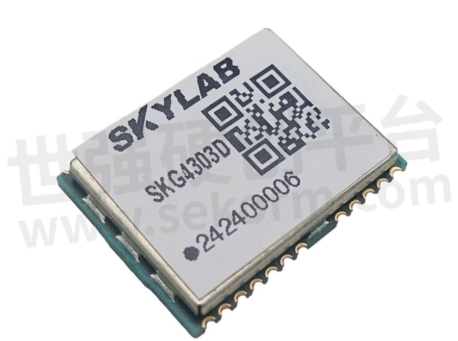
There are many different models and brands of Beidou high-precision positioning modules available for selection in the market. For example, SKYLAB's SKG4303D dual frequency single BeiDou navigation and positioning module integrates SOC baseband and RF integrated chip inside the module. The chip has a single BeiDou certification certificate and can support BDSB1I+B1C+B2A frequency points, fully supporting the BeiDou three signals. It can provide users with strong anti-interference, low power consumption, and high-quality positioning and navigation solutions.
When selecting the high-precision positioning module of Beidou, the following factors need to be considered: positioning accuracy, sensitivity, supported satellite systems, data update rate, interface type, operating temperature range, power consumption, size, cost, etc., to meet the specific application requirements. At the same time, attention should also be paid to the stability and reliability of the module, as well as the technical support and after-sales service of the supplier.
- |
- +1 赞 0
- 收藏
- 评论 0
本文由莫子若转载自SKYLAB Official Website,原文标题为:PDOP value of BeiDou satellite navigation system, BeiDou positioning module,本站所有转载文章系出于传递更多信息之目的,且明确注明来源,不希望被转载的媒体或个人可与我们联系,我们将立即进行删除处理。
相关推荐
一文解析北斗卫星导航系统的PDOP值以及常见北斗高精度定位模块的特点
北斗卫星导航系统实际星座PDOP值已达国际领先水平。导航星座的指标参数主要包括在轨可用卫星数量和空间精度衰降因子(PositionDilutionofPrecision,PDOP)。北斗高精度定位模块是一种能够实现高精度定位的设备,通常集成了北斗卫星导航系统的相关技术。本文天工测控解析北斗卫星导航系统的PDOP值,并给大家介绍常见的北斗高精度定位模块的特点。
Beidou Assistance, Agricultural Machinery Operation Opens up A New Era of Intelligence
In the vast world of modern agriculture, the power of technology is constantly reshaping every aspect of agricultural production. Today, we will focus on the miraculous application of the single Beidou module in agricultural machinery operations.
SPI接口的GPS模块如何实现定位——以天工测控SKG123S为例说明
GPS模块是由GPS接收器、天线和相关的电路组成,它能够通过卫星信号精确的定位到终端的具体地理位置,为其提供位置、速度、时间和方向等信息。GPS模块通常通过串口或USB接口与设备进行通信,并提供 NMEA格式的位置数据。天工测控模组以其卓越性能,可以为车载和便携式手持等定位终端产品的制造提供了高灵敏度、高精度、低成本的定位、导航等解决方案,能满足专业定位的严格要求与个人消费需要。
天工测控单北斗模块助力农机作业,开启智慧农业新时代
本文,我们要聚焦的是单北斗模块在农机作业上的神奇应用。单北斗模块在农机作业上的应用,为现代农业带来了新的机遇和挑战。它让我们看到了科技与农业的完美结合,也让我们对未来的农业发展充满了期待。让我们共同迎接北斗助力下的农机作业智慧新时代,为乡村振兴和农业现代化贡献更多的力量。
【选型】交通信号灯高精度天工测控GNSS授时模块选型技巧
交通信号灯在一定程度上能够起到缓解交通压力的作用,而作用其中的GNSS授时模块才是主力高效,准确,实时的对城市交通信号灯进行统一授时的大功臣。本文天工测控就以北斗授时模块为切入点,简单介绍一下交通信号灯授时模块的选型要点。
SAIC Anji Logistics Halves Inventory Time with Silion‘s RAIN RDIF and Drones
SAIC Anji Logistics, a subsidiary of China‘s largest car manufacturer, uses RAIN RFID-powered drones to conduct inventory checks of finished vehicles. By placing UHF RFID tags on each vehicle, drones can fly over and collect data accurately, reducing inventory input time by 50% and increasing accuracy. This solution saves human labor for more impactful tasks.
【元件】天工测控WIFI模块SKW92A,工作速率达144Mbps,电源电压3.3V,广泛用于物联网领域
天工测控WIFI模块SKW92A,它包含有一个802.11n MAC和基带、一个2.4GHz无线电和FEM、一个580MHz MIPS CPU、一个5端口10/100快速以太网交换机。并且适用于低功耗、低成本和高集成度的AP路由器和消费电子设备。
Drone Mapping vs. Drone Surveying: What’s the Difference?
This article mainly tells Grepow about the difference between drone mapping and drone surveying and introduces the working principle of the two types of drones.
The EPC9173 GaN IC Allows Designers of EBikes and Drones to Simplifying Design for Faster Time-To-Market
The EPC9173 tool allows designers of eBikes and drones to enhance motor system size, performance, range, precision, and torque, all while simplifying design for faster time-to-market. The EPC23101 GaN IC featured in this design has exceptionally high electron mobility and a low-temperature coefficient.
【经验】天工测控UWB定位基站如何安装调试
为方便客户UWB高精度室内定位方案的快速落地,接棒SKYLAB潜心研究蓝牙/UWB室内定位的专业室内定位方案商——微能信息(95POWER)推出了基于UWB工卡,UWB手表及UWB基站的最简室内定位演示套件。本篇小编就来简单介绍一下UWB定位基站的安装和调试方式。
随着授时技术的发展与北斗的崛起,天工测控研发的SKG12DT授时精度达到15ns RMS
深圳市天工测控技术有限公司研发的SKG12DT授时精度达到15ns RMS,是一款高性能GNSS功能超级一体化解决方案计时模块,具有高灵敏度、超低功耗和小体积特性。射频信号通过天线输入道模块,像位置、速度和时间这些串行信息通过nmea协议或自定义协议完整的记录下来。
电子商城


登录 | 立即注册
提交评论